Jennifer Kalt of Humboldt Baykeeper released a community call-to-action through the Northeast Environmental Center in Feb. 2017 to discuss the need for preparation against sea level rise within the area. In the press release, she compares the California Coastal Commission Sea Level Rise Policy Guidance, adopted on Aug. 12, 2015, with the policy plans for the cities of Eureka and Arcata.
The California Coastal Commission was established by voter initiative in 1972 and was made permanent by the California Coastal Act of 1976. Their goal is to protect and enhance California’s coast.
Cristin Kenyon, a local Supervising Analyst with the California Coastal Commission, was able to explain some of the responsibilities of the organization.
“So the Coastal Commission, we basically permit development in the coastal zone but we also certify local governments, policies and regulations as local coastal programs,” Kenyon said. “We can delegate jurisdiction to them so that within their jurisdiction they get to issue the coastal development permits, and we just serve an appeal function.”
When the local governments are certified, it allows for them to control their own development of coastal areas. However, their decisions still have to be in accordance with the Coastal Commission’s regulations and must go through the proper channels to be approved. Analysts like Kenyon help to evaluate development applications and process them on to the Coastal Commision.
“The Coastal Commission is the body that actually makes the decisions,” Kenyon said. “So I get applications for development, review them and write a staff report… recommending approval… denial or approval with conditions to the commission.”
The Coastal Commission’s 2015 Sea Level Rise Guidance report was created as a set of interpretive guidelines and examples to help communities and governments prepare for sea level rise.
They are not a set of regulations, but a well-compiled source of information provided by the “best available science” in order to help communities make more educated development and policy plans.
In Kalt’s press release, she also discusses parts of the Coastal Commission’s 2015 Sea Level Rise Guidance report.
“The Coastal Commission’s 2015 Sea Level Rise Guidance is based on the best available science, and forecasts sea level rise of 0.5m (1.6’) by 2050 and 1.5m (4.9’) by 2100,” Kalt writes.
The Intergovernmental Panel on Climate Change (IPCC) came out with the most updated global scale assessment of sea level rise in 2013. These projections may be updated soon based on more recent information, according to Kenyon. But when the Coastal Commission’s 2015 Sea Level Rise Guidance came out, the 5th Assessment Report (AR5) was the most factual prediction. Because the IPCC altered the model inputs between AR4 and AR5, this model was the most updated. Additionally, the IPCC AR5 accounted for melting ice sheets as an increase in sea level rise.
The IPPC 5th Assessment report concluded, “a rise in global average sea level by 10-39 in [26 to 98 cm] by the year 2100 [relative to mean sea level from 1985 to 2005] depending on the emissions scenario.”
With different studies continuing to show an increase in sea level rise, more communities are working to establish plans and policies to prepare. In Kalt’s press release, she identifies the three basic strategies in preparing for sea level rise:
1. Protection with higher levees, dikes or seawalls
2. Adaptation by elevating structures, increasing setbacks along streams and floodplains, and restoring coastal wetlands to absorb wave energy
3. Relocation of buildings and infrastructure, while prohibiting new development in areas at risk
These main strategies are the base of most sea level rise planning projects. The Coastal Commision uses these adaptation strategies when assessing coastal resources.
“It’s just going to be a really tricky situation along the coast of California, because there’s so much development in these vulnerable areas,” Kenyon said. “And with sea level rise there’s going to be even more areas that are highly vulnerable.”
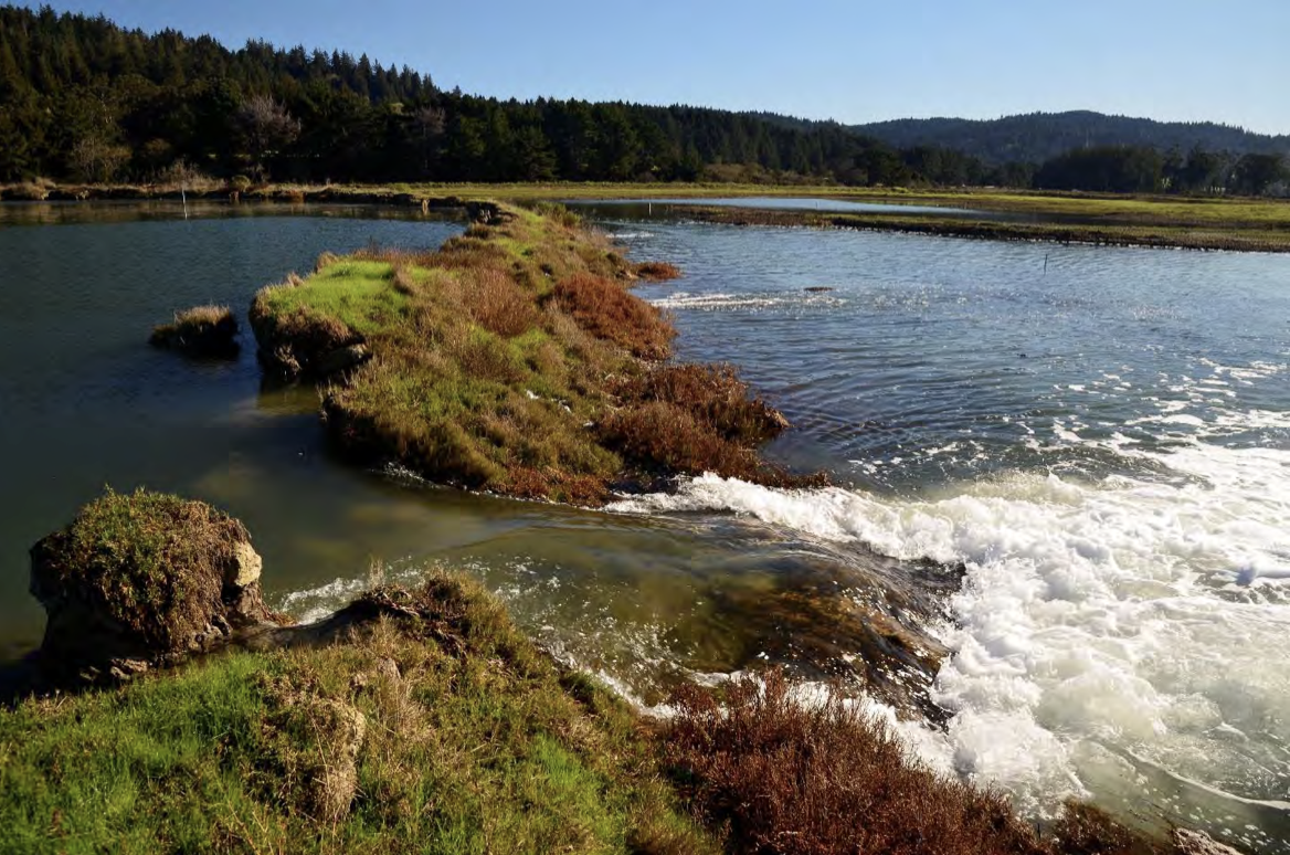
The Humboldt County coastline is particularly vulnerable, because in addition to the sea level rising, the ground beneath the area is sinking deeper due to tectonic subsidence.
“We know that Humboldt Bay is subsiding, so the Humboldt Bay is actually going to be impacted greater than other places,” Kenyon said.
Over the last couple years, Environmental Planner Aldaron Laird has been working on creating sea level rise risk assessments for the Humboldt Bay, the cities of Eureka, Arcata and other areas of Humboldt County. He has extensively researched the area and how it can be expected to respond to sea level rise considering our unique location and vulnerability to the rising waters.
“Humboldt Bay has subsided from tectonic activity and the open ocean has expanded through thermal expansion,” Laird said. “With the two together, we have had the highest rate of sea level change on the entire west coast of the United States right here in Humboldt Bay.”
Because we are in a higher risk area, Humboldt County as a whole have received state funding to help them prepare for sea levels rising. Laird has completed risk assessments to help the local governments determine how to best prepare.
“The vulnerability assessments that have been completed are essentially an inventory of what is at risk and in what areas are they at risk, and when they may be impacted by sea level rise,” Laird said.
Kant continues to summarize parts of Laird’s Sea Level Rise Vulnerability Assessment for Eureka in the press release.
“Environmental planner Aldaron Laird recently completed Eureka’s Sea Level Rise Vulnerability Assessment, which found that by 2050, sewer lift stations, sewer lines, and the Murray Field airport will be the most at-risk public assets,” Kalt wrote. “By 2100, the Chevron Fuel Terminal, bulk cargo docks, drinking water and stormwater systems and contaminated sites will be most vulnerable.”
Kalt then goes on to use Laird’s research as well as the Coastal Commission’s Guidance report to evaluate the policy plans made by the City of Eureka in their latest general plan update draft.
“In mid-December, the City of Eureka’s staff unveiled draft sea level rise policies that recommend planning for only six inches of sea level rise by 2050—in defiance of Coastal Commission guidance,” Kalt wrote. “This approach is at odds with common-sense strategies to plan for the future and could result in costly damage by putting new development in areas vulnerable to flooding.”
While it may be disheartening to read that the City of Eureka is not planning on following the guidance of the Coastal Commission, it is not the end of the policy debate. The general plan for Eureka is still in its draft form, but it is expected to be completed in the fall of 2018. Until it is fully completed, the public has a say in what is in the plan and can work to change the sea level rise preparation policies.
Kristen Goetz is a senior planner with the City of Eureka working on the city’s General Plan Update.
“There will be public hearings prior to the general plan update which will include the sea level rise goals and policies,” Goetz said. “Then there will be the process with the coastal commission, during which time there will be at least one public hearing and maybe more, depending on how that process goes with them.”
“We’re looking at a planning horizon right now of 2040,” Goetz said. “So in 18ish more years, the planners who are with the city at that point in time are going to be doing another general plan update. They are going to be 20 years closer to that 2100 point in time and they will have a much better idea of what the forecasted levels are for sea level rise… and how they are going to affect the City of Eureka.”
With Eureka planning for 2040, there is a chance the community may not be prepared to deal with the situation well. Unless something dramatic happens to demonstrate that sea levels are rising faster than already anticipated, the city plans to continue with their original plan.
“If something happens between now and the next general plan update, for example, and sea level rise is increasing faster than what the studies are showing right now… then I think that the City of Eureka would speed up our review and our planning for the protection of infrastructure or retreat,” Goetz said.
However, if you don’t want to wait for some random natural disaster that increases the rate of sea level rise there are simple things you can do as a member of the community to impact the policy around sea level rise. Almost a year ago Humboldt Baykeeper Jennifer Kalt wrote the press release asking the public to get involved, in which she urged community members listen to the science that is telling us our home is vulnerable.
The time to get involved is now.
The Humboldt Bay Sea level Rise Adaptation Planning Project was released in two phases the first in January of 2013 and then the second phase in February 2015, then Laird completed the assessments for the cities of Eureka and Arcata.
Most recently Laird finished the assessment for Humboldt County, “the Humboldt Bay area plan that covers all the unincorporated area on Humboldt Bay,” said Laird. Laird just completed the Sea Level Rise Assessment for the rest of Humboldt County, planning to send the final assessment over to the Coastal Commission on Jan. 12, the document can be expected to be released to the public within the next week.
With all of the risk assessments done and about to be available to the general public, community members now have more resources than ever to help determine how the area needs to prepare for sea level rise. It also means that the local governments will be working on new policies based off of the new information. Sea level rise is happening and it seems slow. But a prediction of 10-39 in. by 2100 could happen faster than we think. Further, accounting for six inches of sea level rise for the year 2040 may not be enough.